


Most users are unaware that they can easily upload their Excel/CSV files that contain longitude and latitude to ArcGIS Online directly rather than creating a single feature class via ArcMap or ArcGIS Pro. This article is divided into two sections,
Initially, you will need to prepare your excel file and make sure it has columns for longitude and latitude. Then, you can name them either that, or you can mention x and y as headers.
Then head over to ArcGIS Online and login in with your public ID. After logging in, you can then go to the "Content" menu (Step 1), as seen in the image below.
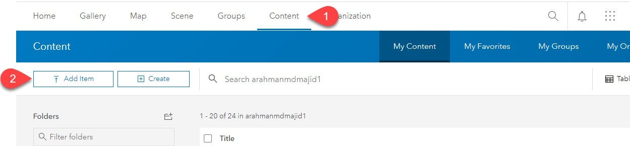
From there, you can click on the "Add Item" submenu (Step 2).
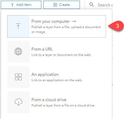
The Add item dropdown menu will provide you different options to chose from. For us, we are selecting the "From your Computer" option (Step 3)
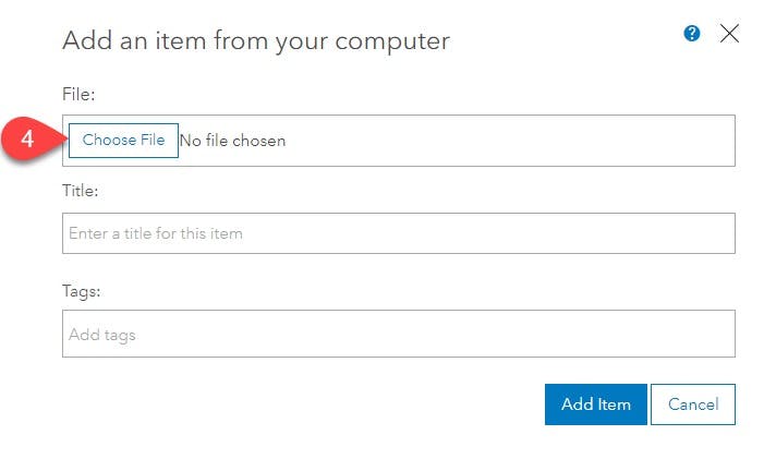
From there, another window will display where you'll have to select the relevant file (Step 4) and a suitable title to it and add tags so that you can later find it easily.
As the file is uploaded, the same will extend, and more options will appear. Now here the magic happens if you want to publish this file as a hosted layer, mark the check box (Step 5).
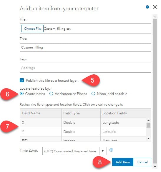
The user is also asked what type of location data the system should expect; either the file contains coordinates or just plain addresses, which will get geocoded automatically. For us, we will check the coordinates radio button (Step 6).
The user can also review the data types and select appropriate data types. The third column identifies which column is used for longitude and latitude (Step 7). Additionally, you can also select the time zone for the uploaded data. After this, we can click on Add Item (Step 8).
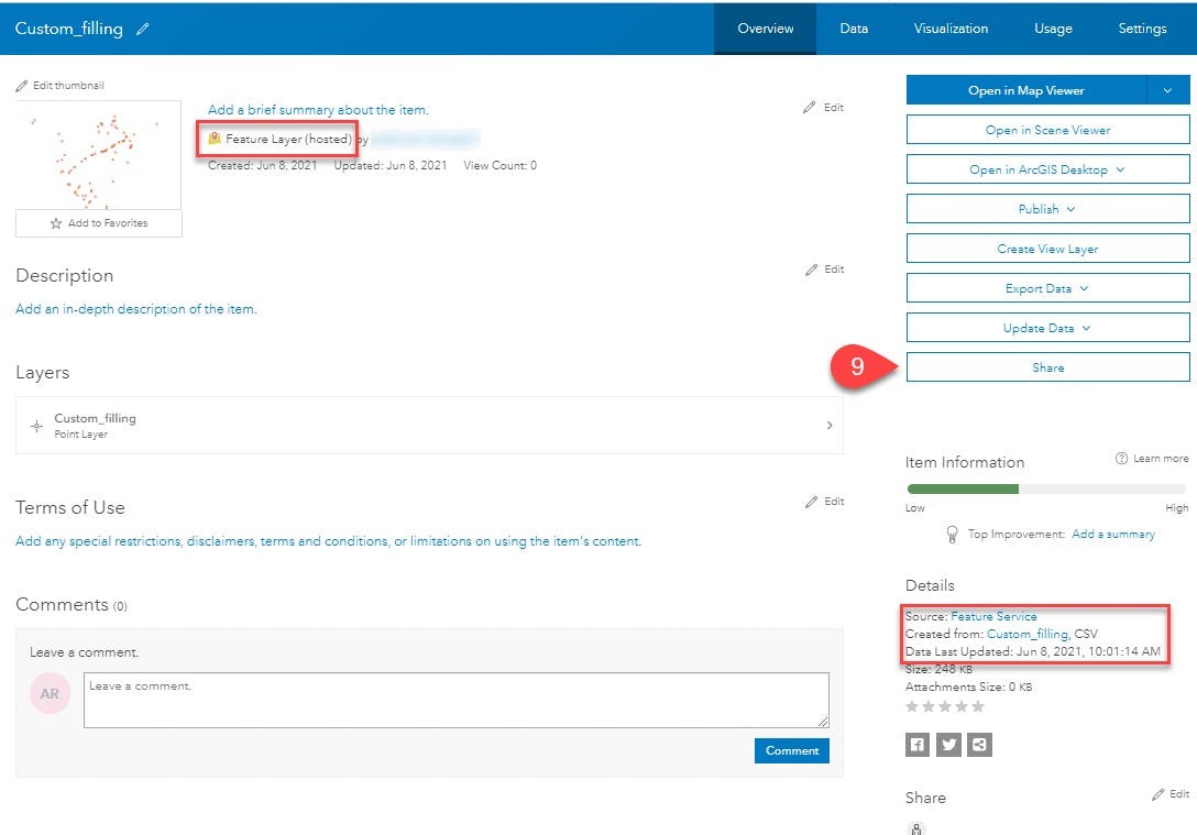
The configured file will upload to the contents and the main page for the hosted feature layer. To share the feature layer, we can select the share button on the right-hand side of the page (Step 9).
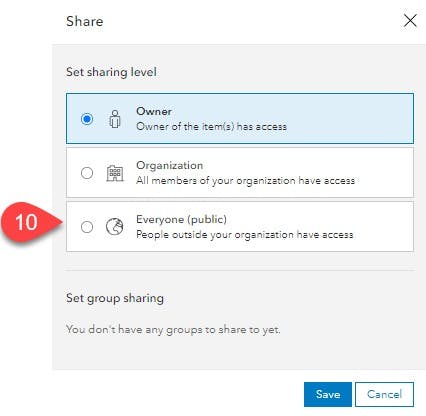
This opens a window to select if you want to select with just the organization members or share it with the public (Step 10). By default, the uploaded feature service is private.
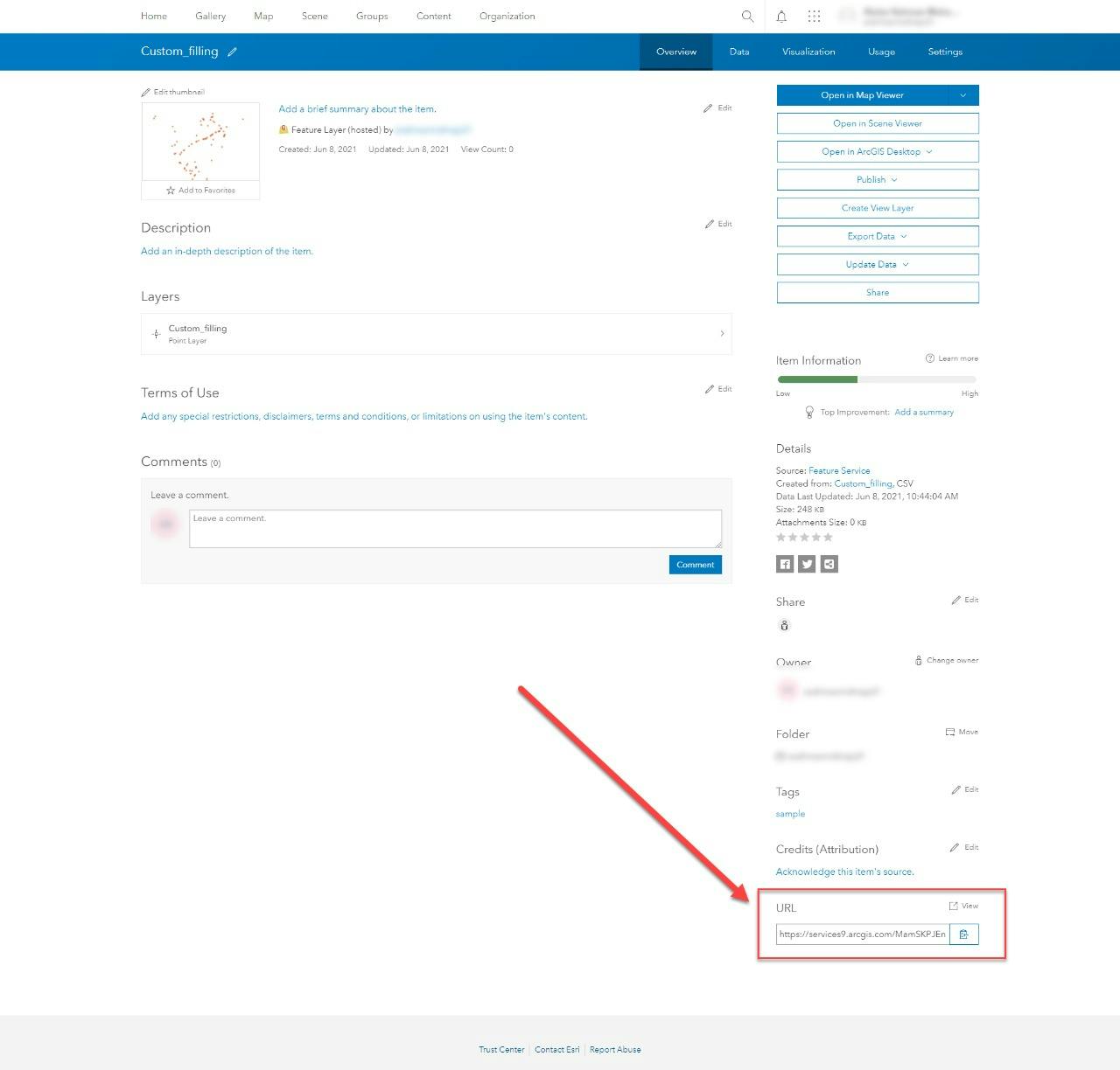
Finally, the link to the service is located at the bottom right corner of the screen.
This concludes our article on adding a single excel file and publishing them to be utilized with many ESRI products and applications. Most prominently, it can be utilized by your custom web and mobile mapping applications.
Let me know what you think of the article and if you guys need help with other features of ArcGIS products.